


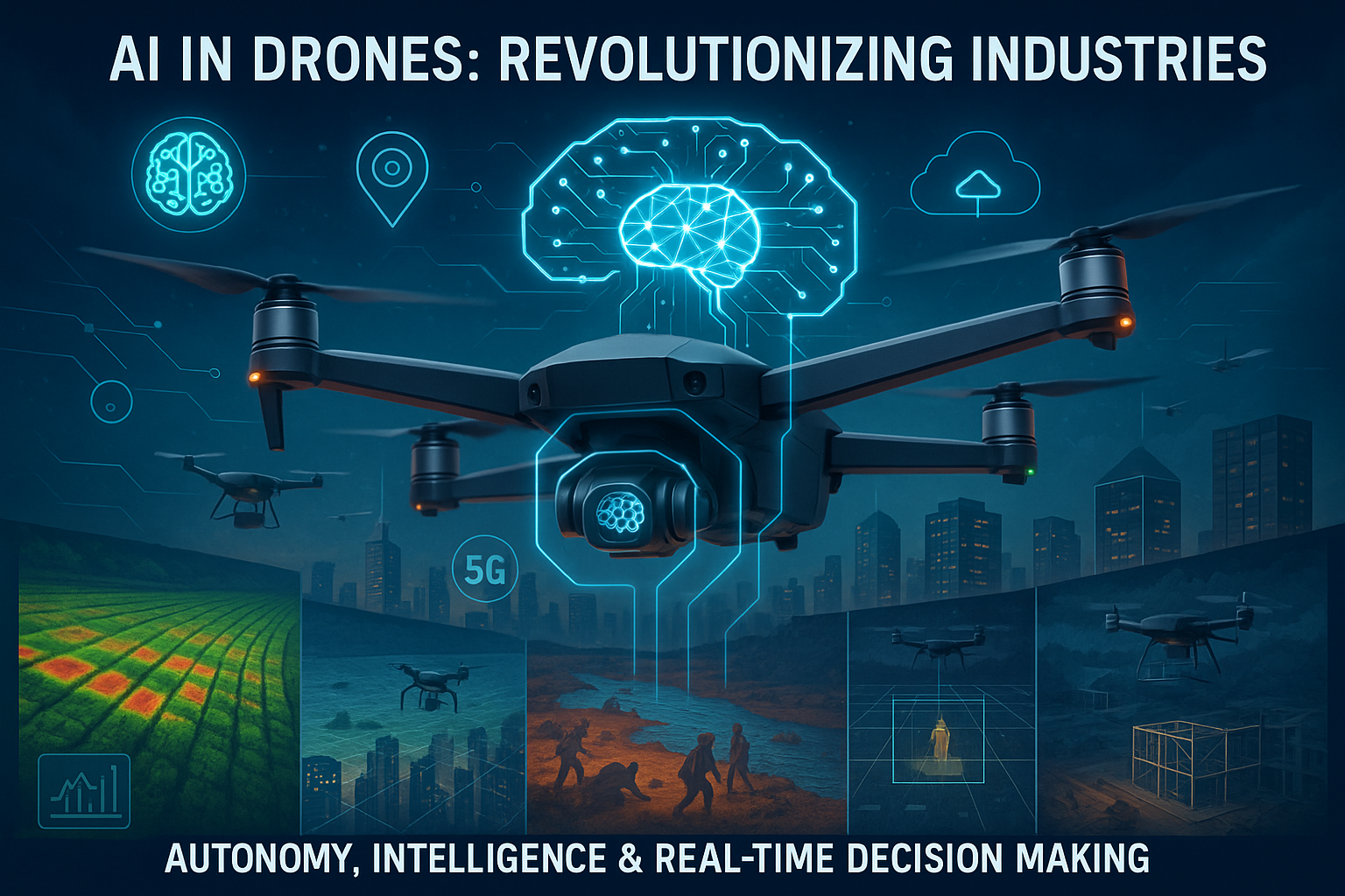


Introduction: How Drone Technology Is Transforming America in 2026
Drone technology has become an important part of America’s evolving technology landscape. What was once mainly associated with aerial photography, recreational flying, and military operations is now being used across commercial industries, including logistics, agriculture, construction, public safety, energy, and transportation.
In 2026, American businesses are exploring how drones can perform work that traditionally required helicopters, ground vehicles, manual inspections, or teams of field workers. Equipped with high-resolution cameras, GPS navigation, artificial intelligence (AI), thermal sensors, and automated flight systems, modern drones can collect information, inspect difficult-to-reach locations, and support faster decision-making.
The Federal Aviation Administration (FAA) plays a central role in this development by establishing safety requirements and managing how drones operate in American airspace. Its ongoing work on advanced drone operations, including flights beyond the pilot’s visual line of sight, is particularly important for businesses seeking to expand delivery networks and automated inspections. The FAA’s official guidance explains the existing requirements and the additional approvals that certain operations may need.
Commercial developments are also attracting attention. In July 2026, DoorDash announced that it had received FAA Part 135 air-carrier certification for its in-house drone delivery program, DoorDash Air. Meanwhile, Amazon Prime Air and other operators continue to demonstrate the potential of aerial delivery, alongside questions about noise, safety, privacy, and community acceptance.
This article explores the major developments shaping drone technology in the USA in 2026, the companies and industries involved, the challenges that remain, and the opportunities that could emerge over the coming years.
1. What Is Modern Drone Technology?
A drone, formally known as an unmanned aircraft system when considered alongside its control and supporting components, is an aircraft that operates without a person onboard. Depending on its design, a drone may be controlled remotely by a pilot or follow a programmed route using onboard navigation and automated flight systems.
Modern commercial drones combine several technologies:
- GPS and satellite navigation: Help determine location and follow planned flight routes.
- Artificial intelligence: Supports image analysis, object recognition, navigation assistance, and automated data processing.
- High-resolution cameras: Capture aerial images and video for mapping, inspection, and documentation.
- Thermal sensors: Detect temperature differences that can help identify overheating equipment or heat loss.
- Obstacle-detection systems: Use cameras, radar, lidar, or other sensors to help identify potential hazards.
- Communication systems: Connect drones with operators, control platforms, and other supporting services.
- Automated flight software: Helps manage missions, record flight data, and repeat routine operations.
Not every drone includes all these features. Equipment depends on the aircraft’s intended purpose, price, operating environment, and regulatory requirements.
The major change in 2026 is not simply that drones can fly longer or carry better cameras. It is that hardware, software, navigation, and data analysis are increasingly being combined into complete commercial systems.
2. Artificial Intelligence Is Making Drones More Capable
Artificial intelligence is becoming an important component of professional drone operations. Instead of requiring a person to manually examine every photograph or video, AI-powered software can help identify patterns, detect visible damage, classify objects, and prioritize areas that require attention.
For example, a construction company may use drone images to compare a building site against earlier surveys. AI software can help identify differences in the site layout or flag areas for closer inspection. Similarly, an energy company may analyze aerial imagery to locate vegetation near power lines or identify visible defects in infrastructure.
AI can support several drone applications:
Automated inspection
Drones can capture images of bridges, towers, roofs, solar installations, and industrial facilities. Computer vision software can help organize those images and flag potential problems for human review.
Intelligent route planning
Flight-planning systems can calculate routes based on distance, battery capacity, weather conditions, restricted airspace, and mission requirements. Advanced systems may also help operators adapt routes when conditions change.
Faster data analysis
A drone can collect thousands of images during a large survey. Automated software can help convert the images into maps, three-dimensional models, and inspection reports.
Improved operational awareness
Depending on the equipment and software, onboard sensors may help a drone recognize obstacles or respond to certain flight conditions.
However, AI does not make every drone fully autonomous or guarantee safe operation. Human oversight, reliable sensors, software testing, and compliance with applicable aviation rules remain essential.
3. Drone Delivery Is Expanding in the United States
Drone delivery is one of the most visible commercial applications of unmanned aircraft technology. The idea is straightforward: instead of sending every small package through roads and conventional delivery vehicles, an eligible shipment can travel by air from a designated launch point to an approved delivery location.
Potential advantages include shorter delivery times for selected routes, reduced dependence on road access, and better service to certain remote or hard-to-reach locations.
DoorDash Air and local commerce
In July 2026, DoorDash announced that its DoorDash Labs division had earned FAA Part 135 air-carrier certification for its in-house drone delivery program. This development illustrates how companies focused on local commerce are exploring aerial delivery as an additional option for serving customers.
The practical benefit will depend on where the service operates, the items it can carry, delivery distance, weather, operating costs, and the availability of suitable landing or drop-off locations.
Amazon Prime Air
Amazon has also invested in drone delivery through its Prime Air program. The company’s approach focuses on delivering eligible packages using specially designed aircraft and approved operating procedures.
Expanding these services involves more than building a drone. Operators need launch facilities, reliable communication, trained personnel, aircraft maintenance, airspace approvals, and systems for handling unexpected conditions.
Medical and essential deliveries
Drone delivery may be particularly useful for transporting selected medical supplies, laboratory samples, and other time-sensitive items. Hospitals and healthcare providers can benefit when an approved aerial route reduces transportation time between facilities.
However, medical deliveries require careful handling, appropriate packaging, and processes that protect the quality and integrity of the transported materials.
Why nationwide drone delivery is still challenging
A successful pilot program does not mean every American neighborhood will immediately receive drone deliveries. Operators must account for weather, battery limitations, noise, obstacles, public acceptance, and the regulatory requirements associated with their operations.
The FAA’s package-delivery framework explains that eligible commercial operators need the appropriate certification and authorization. Flights beyond visual line of sight may require additional approvals under the applicable rules and exemptions.
Source: FAA — Package Delivery by Drone
4. Precision Agriculture: Drones Are Changing American Farming
Agriculture is another important market for drone technology in the USA. Farms cover large areas, and checking every field manually can require significant time and labor. Drones provide farmers with an aerial view that can help them monitor crops and identify areas requiring attention.
Crop monitoring
A drone equipped with suitable cameras can capture images showing crop growth, field conditions, and visible changes across different sections of a farm. When these images are compared over time, they can help farmers investigate areas where crops are developing differently.
Irrigation management
Aerial imagery and specialized sensors can support irrigation planning by helping identify unusual field patterns. Thermal or multispectral equipment may provide additional information, although measurements must be interpreted correctly and may require confirmation on the ground.
Targeted application of agricultural products
Some agricultural drones are designed to apply approved products to crops. Depending on the aircraft, product, and operation, specialized federal and state requirements may apply. In the United States, certain dispensing operations fall under FAA agricultural aircraft rules, including Part 137.
Reduced field-inspection time
Drones can help farmers survey large areas without driving across every section of a field. They can also collect repeatable imagery that supports recordkeeping and communication with agronomists.
Despite these advantages, agricultural drone adoption depends on equipment costs, training, battery management, software, weather, and the size and type of farm. A drone provides useful information, but it does not replace sound agricultural expertise.
5. Construction, Mapping, and Infrastructure Inspection
Construction companies, engineering firms, utility providers, and survey professionals increasingly have reasons to examine sites from above.
Aerial data can help teams understand site conditions, document progress, and investigate locations that are difficult or dangerous to reach.
Construction progress tracking
A drone can capture images of a construction site at regular intervals. Teams can compare these images with project plans and earlier records to understand how work is progressing.
When processed with suitable software, aerial photographs can also contribute to orthomosaic maps and three-dimensional models.
Bridge and road inspections
Inspecting infrastructure often requires equipment, traffic controls, elevated platforms, or specialized crews. A drone can provide an initial visual assessment of selected structures and help identify areas that deserve a closer examination.
A drone inspection does not automatically replace certified engineering inspections. Close-up examinations, physical testing, and professional assessments may still be necessary.
Power lines and renewable energy installations
Utility operators can use drones to capture images of transmission towers, substations, wind turbines, and solar farms. Thermal sensors may help identify temperature anomalies in compatible equipment.
These inspections can support maintenance planning and help workers prioritize potential problems before sending crews to specific locations.
Mining and land surveying
Drones can collect aerial data that supports topographic mapping, stockpile measurement, site documentation, and selected surveying workflows.
The value comes from combining repeatable aerial data with appropriate processing software and professional interpretation.
6. Public Safety, Emergency Response, and Disaster Management
Public safety is another area where drone technology can provide practical benefits. Fire departments, emergency management teams, search-and-rescue organizations, and other authorized agencies may use drones to gather information when ground access is difficult.
Search and rescue
A drone with a suitable camera can search areas more quickly than a person walking every section of difficult terrain. Thermal imaging may assist in locating a person under suitable conditions, although performance depends on weather, vegetation, equipment, and the surrounding environment.
Fire and disaster assessment
After a wildfire, flood, storm, or earthquake, aerial imagery can help officials assess damaged roads, buildings, and infrastructure. Drone data may support decisions about where to send emergency personnel and equipment.
Hazardous-area inspection
Drones can provide remote visual information about certain hazardous locations, reducing the need to send personnel into an area before its conditions are understood.
Emergency medical support
In appropriate settings, drones may help transport selected supplies or support communication and assessment activities. Any such operation must account for aviation safety, payload requirements, and the procedures of the responsible emergency organization.
Public-safety operations can also face limitations. Emergency aircraft, helicopters, and drones may share the same airspace, so coordination and compliance with airspace restrictions are crucial.
7. American Drone Companies and the Competitive Landscape
The US drone ecosystem includes aircraft manufacturers, software developers, delivery operators, defense contractors, and companies supplying sensors, batteries, communication systems, and data-analysis tools.
Several organizations illustrate the range of commercial activity in this sector.
Wing
Wing, associated with Alphabet, has developed drone delivery technology focused on transporting eligible small items. Its operations demonstrate how aerial logistics can be integrated with ordering systems and local delivery infrastructure.
Learn more: Wing
Amazon Prime Air
Amazon’s Prime Air program focuses on package delivery using purpose-built drones and supporting logistics systems.
Learn more: Amazon Prime Air
Zipline
Zipline is known for drone logistics and delivery systems, particularly in healthcare and other time-sensitive supply chains. Its experience highlights the importance of combining aircraft with reliable distribution infrastructure.
Learn more: Zipline
Skydio
Skydio develops autonomous drone systems and related software for enterprise, public-sector, and inspection use cases. Its technology illustrates the role of onboard autonomy and computer vision in professional drone operations.
Learn more: Skydio
These companies do not all operate in the same market. Some emphasize delivery, while others focus on industrial inspections, public safety, or autonomous flight. Their commercial success depends on product reliability, regulatory compliance, customer demand, and the ability to deliver measurable value.
8. Drone Regulations in the USA in 2026
Aviation regulation is one of the most important factors affecting the future of commercial drones in America. Drones operate in airspace that is also used by passenger aircraft, helicopters, emergency services, and other aviation users.
The FAA establishes rules intended to support safe operations while allowing useful new technologies to develop.
Part 107 for many small commercial drones
Many small commercial drone operations are governed by 14 CFR Part 107. The FAA’s published guidance describes requirements that include avoiding crewed aircraft, operating safely, and maintaining visual-line-of-sight conditions unless an applicable authorization or waiver permits otherwise.
Operators must check the requirements that apply to their specific aircraft and mission. Commercial pilots generally need the relevant FAA remote pilot certification, and registration requirements apply according to the rules governing the aircraft and operation.
Official resource: FAA — Small Unmanned Aircraft Systems Regulations
Beyond visual line of sight
Beyond visual line of sight, commonly abbreviated as BVLOS, refers to drone operations in which the aircraft flies outside the pilot’s direct visual line of sight.
BVLOS is important because it can support longer-range delivery, infrastructure inspection, agricultural operations, and automated missions over large areas.
The FAA has been developing a framework to support more routine and scalable operations. Its 2025 proposal addressed performance-based rules for BVLOS operations and supporting services. The status of final rules and the requirements for any particular operation should be checked against current official FAA guidance.
Official resource: U.S. Department of Transportation — BVLOS Rulemaking
Drone traffic management
As the number of professional drone flights grows, operators need systems that help them plan routes, identify airspace constraints, and reduce the risk of conflicts.
The FAA describes Unmanned Aircraft System Traffic Management (UTM) as a collaborative framework for managing low-altitude drone operations. Such systems may support flight planning, authorization, surveillance, and conflict management.
Official resource: FAA — Unmanned Aircraft System Traffic Management
Registration, identification, and local restrictions
Drone owners and operators should verify applicable registration, Remote ID, airspace authorization, and operational requirements before flying. Some locations have additional restrictions, including near airports, sensitive facilities, and certain public events.
Rules can vary according to aircraft type, intended use, location, and operating conditions. Reading official guidance is more reliable than assuming that a drone can fly anywhere simply because it is small.
9. Privacy, Security, and Community Concerns
The growing use of drones creates questions that manufacturers and operators must address alongside technical performance.
Privacy
Drones may carry cameras capable of recording homes, workplaces, public areas, or private activities. Responsible operators should establish clear policies about what they collect, why they collect it, how long they retain it, and who can access it.
Businesses should also consider applicable privacy laws and local restrictions.
Cybersecurity
Connected drones can rely on communication links, navigation data, cloud platforms, mobile applications, and software updates. Weak security can create risks involving unauthorized access, data exposure, or disruption of operations.
Useful safeguards include strong authentication, secure communications, controlled access to flight data, timely software updates, and documented incident-response procedures.
Noise and neighborhood acceptance
Delivery drones may generate recurring noise, especially when multiple aircraft operate near homes. Communities may also have concerns about flight paths, landing locations, and the frequency of operations.
Operators can improve public acceptance through transparent communication, responsible route planning, and effective procedures for handling complaints.
Physical safety
A malfunctioning drone can injure people or damage property. Safe operations therefore require appropriate maintenance, battery handling, pilot training, emergency planning, and compliance with operating limits.
Innovation will be more sustainable when safety and community concerns are addressed from the beginning rather than after a service expands.
10. The Role of Batteries, GPS, and Connectivity
Drone performance depends on more than the aircraft’s frame and motors. Batteries, navigation, communication, and software all influence what a drone can accomplish.
Battery technology
Battery capacity affects flight duration, payload, and the distance a drone can travel. Carrying a heavier payload generally increases energy demand, so manufacturers must balance endurance with the aircraft’s intended job.
Improvements in battery chemistry, charging systems, and energy management may help future aircraft operate more efficiently. However, actual performance varies with temperature, wind, battery age, and payload weight.
GPS and navigation
Satellite navigation helps drones determine their position and follow planned routes. Many systems also use inertial sensors, cameras, and other positioning methods to support flight control.
GPS is not infallible. Signal interference, obstructions, and other disruptions can affect navigation. Professional systems need appropriate contingency procedures and may use additional sensors to improve resilience.
Wireless connectivity
Reliable communication can help operators monitor aircraft status, receive telemetry, and transfer mission data. Connectivity requirements vary by mission, and a drone should not be assumed to have unlimited communication coverage.
For long-range operations, communication reliability and lost-link procedures are particularly important.
11. Economic Opportunities and Drone Careers
As drone applications grow, businesses may need workers with expertise in aviation, software, data analysis, maintenance, and operational planning.
Potential career paths include:
- Commercial drone pilot.
- Drone operations coordinator.
- Aerial mapping and surveying specialist.
- Drone maintenance technician.
- Robotics and autonomous-systems engineer.
- Computer vision and AI developer.
- Aviation safety and compliance specialist.
- Geospatial data analyst.
- Drone fleet and logistics manager.
Not every job requires an engineering degree. Some roles focus on piloting, field operations, documentation, maintenance, or customer support. However, commercial flying often requires relevant certification, and specialized positions may require additional education or experience.
For businesses, drones can create value when they reduce inspection time, improve data quality, lower exposure to hazardous tasks, or enable services that would otherwise be impractical.
The financial case should be evaluated carefully. Aircraft purchases, insurance, training, software subscriptions, maintenance, batteries, approvals, and staff time all contribute to the total cost of ownership.
12. The Future of Drone Technology in the USA
The next stage of American drone development is likely to focus on integrating aircraft into repeatable, well-managed commercial workflows rather than treating each flight as a separate experiment.
Several developments deserve attention.
More automated operations: Businesses will continue exploring automated mission planning, repeatable inspections, and fleet-management platforms. The level of automation will depend on the aircraft, task, and regulatory approvals.
Expanded delivery networks: More companies may test or expand drone delivery where demand, geography, economics, and approvals support the service.
Better inspection analytics: Improvements in sensors and AI could help organizations turn aerial data into more useful maintenance and planning decisions.
Greater emphasis on domestic supply chains: US policymakers and industry participants have emphasized domestic drone production and trusted supply chains. The White House’s June 2025 executive order, Unleashing American Drone Dominance, highlighted domestic production, commercial adoption, and integration into the national airspace system.
Improved traffic coordination: As more drones operate at low altitudes, traffic-management services and reliable methods for detecting and avoiding other aircraft will become increasingly important.
More attention to security: Manufacturers and buyers are likely to continue evaluating software security, component sourcing, data handling, and operational resilience.
These developments will not happen at the same speed across every industry. Delivery, agriculture, emergency response, and infrastructure inspection have different operational needs and regulatory considerations.
Conclusion
Drone technology in the USA in 2026 is moving beyond recreational flying and specialized experiments toward a wider range of practical applications. AI-assisted inspections, precision agriculture, emergency response, aerial mapping, and commercial delivery show how unmanned aircraft can support American businesses and public services.
Companies such as Amazon, Wing, Zipline, Skydio, and DoorDash illustrate the diversity of the industry. Meanwhile, FAA requirements, reliable navigation, cybersecurity, battery performance, and community acceptance remain central to long-term success.
The future of drones will depend on balancing innovation with safety and accountability. Businesses that choose suitable applications, invest in training, protect data, and follow current regulations will be better positioned to benefit from this evolving technology.
For the United States, drones represent more than a new type of aircraft. They are part of a broader shift toward connected, data-driven, and increasingly automated operations across the economy.
Frequently Asked Questions (FAQs)
1. What is drone technology used for in the USA?
Drone technology is used for aerial photography, agriculture, construction surveys, infrastructure inspection, emergency response, public safety, logistics, and selected commercial delivery services.
2. Which companies are involved in US drone technology?
Companies active in different parts of the ecosystem include Amazon Prime Air, Wing, Zipline, Skydio, and DoorDash. Their services and operating permissions differ.
3. Is drone delivery available everywhere in the USA?
No. Drone delivery is available only in supported areas and under applicable operating approvals. Availability depends on the provider, location, weather, aircraft, and delivery requirements.
4. Do commercial drone pilots need an FAA license?
Many small commercial drone operations under Part 107 require an FAA remote pilot certificate. Operators should verify which rules and qualifications apply to their particular operation.
5. What does BVLOS mean in drone technology?
BVLOS means “beyond visual line of sight.” It describes an operation in which the drone flies outside the pilot’s direct visual line of sight. Applicable authorization and operating requirements must be checked before conducting such flights.
6. How does AI improve drone performance?
AI can help analyze images, recognize objects, support route planning, identify potential defects, and automate parts of data processing. Its capabilities depend on the sensors, software, and operating environment.
7. How are drones used in agriculture?
Farmers may use drones for crop monitoring, field mapping, irrigation assessment, and certain approved application tasks. Specialized equipment and regulatory compliance may be necessary.
8. Are drones safe to use near airports?
Drone operators must follow applicable airspace restrictions and authorization requirements. They should never assume that an area is safe for flight without checking official airspace information.
9. Can drones inspect power lines and bridges?
Yes. Drones can capture visual and thermal information to support inspections. They may reduce the need for some preliminary manual checks, but they do not automatically replace required engineering assessments.
10. What is the future of drone technology in America?
Likely areas of development include automated inspections, commercial delivery, AI-powered data analysis, improved navigation, more coordinated low-altitude traffic management, and stronger domestic manufacturing capabilities.
11. Do drones use GPS?
Many drones use satellite navigation, including GPS, to determine their position and follow routes. Professional systems may also rely on additional sensors, and operators must plan for possible navigation disruptions.
12. What should a business consider before adopting drones?
Businesses should evaluate the intended use, aircraft capabilities, total cost, pilot training, applicable regulations, insurance, data security, maintenance, and expected return on investment.


