


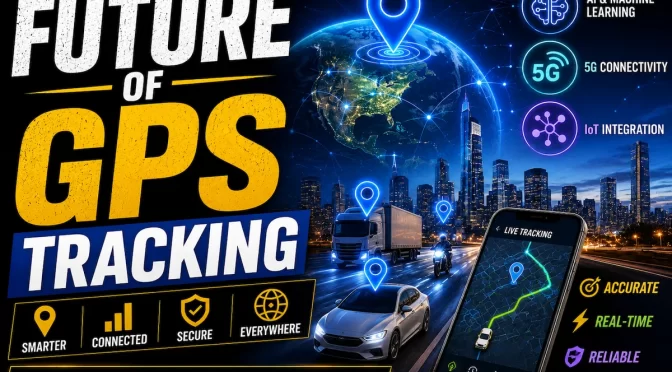


GPS has become one of the most important technologies supporting modern life in the United States. People use it every day for driving directions, food delivery, ride-sharing, fitness applications, emergency services, aviation, logistics, agriculture, mapping, and countless other activities.
For most consumers, GPS appears to be a simple technology. A smartphone receives satellite signals, calculates a location, and displays it on a map.
Behind that simple experience is a highly sophisticated global positioning infrastructure.
The United States operates GPS as a global positioning, navigation, and timing service. According to GPS.gov, the system is an essential part of the world’s information infrastructure and supports hundreds of applications across modern society.
But as dependence on GPS has increased, another issue has become more important: What happens when GPS signals are disrupted?
This question has received renewed attention in the United States during 2026 following incidents involving GPS interference and aviation.
A particularly serious case occurred in New Mexico in May 2026, when a medical air-ambulance aircraft reported losing GPS navigation during a scheduled military jamming exercise. The aircraft later crashed into mountainous terrain, killing four people. The National Transportation Safety Board’s preliminary findings have linked the timing of the GPS loss to the exercise, but investigators have not determined that GPS interference directly caused or contributed to the crash.
The incident has nevertheless highlighted a broader technology challenge.
Modern transportation systems increasingly depend on GPS, while electronic warfare, drone-defense systems, jamming equipment, and other technologies can interfere with satellite navigation.
That creates an important question for the future:
How can the United States maintain reliable positioning, navigation, and timing when GPS signals become unavailable or unreliable?
The answer will likely involve a combination of GPS modernization, backup navigation technologies, improved aviation procedures, multi-sensor systems, AI, alternative positioning technologies, and stronger resilience planning.
What Is GPS Jamming?
GPS jamming occurs when radio-frequency interference disrupts the signals transmitted by GPS satellites.
GPS signals travel from satellites hundreds of thousands of kilometers away, and by the time they reach receivers on Earth, they are relatively weak.
A sufficiently strong interfering signal can make it difficult or impossible for a receiver to process the legitimate GPS signals.
The result may include:
- Loss of GPS position
- Navigation errors
- Incorrect positioning information
- Loss of GPS-based timing
- Navigation system warnings
- Automatic switching to backup systems
The severity of the effect depends on the type of receiver, environment, interference strength, and other factors.
GPS Jamming vs GPS Spoofing
GPS jamming and GPS spoofing are different problems.
GPS Jamming
Jamming attempts to prevent a receiver from properly receiving or processing legitimate GPS signals.
In simple terms, the receiver may stop being able to determine its GPS position.
GPS Spoofing
Spoofing is more deceptive.
Instead of simply blocking the signal, a spoofing system can transmit false signals that cause a receiver to calculate an incorrect position or time.
This can be particularly dangerous because a receiver may continue reporting a location even though that location is wrong.
For critical applications, simply knowing that GPS is unavailable may be easier to handle than receiving convincing but incorrect positioning information.
Why GPS Jamming Is Becoming More Important in 2026
GPS interference is not a completely new issue.
However, its importance is increasing because the number of systems dependent on satellite navigation continues to grow.
At the same time, electronic warfare and counter-drone technologies are becoming more sophisticated.
GPS jamming can be used intentionally in military environments to disrupt navigation or prevent certain systems from using satellite positioning.
The challenge is that radio signals do not always respect the boundaries of the operation for which they were intended.
Interference can potentially affect other nearby users.
This is especially important around:
- Airports
- Highways
- Ports
- Military installations
- Drone operating areas
- Emergency response zones
- Critical infrastructure
The 2026 New Mexico Aviation Incident
The recent New Mexico air-ambulance crash has brought the GPS resilience issue into sharper focus.
According to the preliminary reporting, the aircraft departed Roswell during a scheduled military GPS-denial exercise and the crew reported losing GPS navigation shortly afterward. Air traffic controllers attempted to assist the flight, and the aircraft later crashed in the Capitan Mountains.
It is important not to oversimplify the incident.
Investigators have not concluded that GPS interference alone caused the crash.
Instead, the event demonstrates how multiple factors can become important when a modern navigation capability suddenly becomes unavailable.
Aviation systems are designed with backup procedures, but pilots need to be trained and prepared to use those alternatives.
The incident has therefore renewed discussion about whether navigation infrastructure and operational procedures are keeping pace with modern GPS interference threats.
Why Aviation Depends So Heavily on GPS
Modern aviation uses satellite navigation for many important functions.
GPS can support:
- Aircraft navigation
- Route planning
- Instrument procedures
- Position information
- Navigation approaches
- Air traffic management
- Timing synchronization
The Federal Aviation Administration recognizes GPS and augmentation systems as important components of modern aviation navigation. The agency also addresses issues including GPS modernization, interference, jamming, and spoofing.
This dependence creates a resilience challenge.
Aviation cannot simply assume that GPS will always be available.
Aircraft therefore require backup navigation capabilities and procedures for situations where satellite navigation is disrupted.
What Happens When GPS Fails?
The exact response depends on the vehicle or system.
A modern car may simply switch to another positioning source or continue operating with reduced navigation accuracy.
An aircraft has much more complex requirements.
Pilots may need to rely on:
- Inertial navigation
- Ground-based navigation aids
- Radar vectors
- Visual navigation
- Conventional instrument procedures
- Air traffic control assistance
Autonomous vehicles can use:
- Cameras
- LiDAR
- Radar
- Inertial sensors
- Digital maps
- Wheel odometry
- Alternative satellite systems
The important principle is redundancy.
A critical system should not depend on one source of information whenever failure could create serious consequences.
GPS Modernization Is Part of the Solution
The United States has been modernizing GPS for years.
GPS.gov describes modernization as an ongoing, multibillion-dollar effort involving new satellites, new civilian and military signals, and improvements to the ground control system.
Modern GPS generations provide improved capabilities compared with older systems.
The modernization program includes the introduction of new civilian signals such as:
- L2C
- L5
- L1C
GPS.gov explains that these signals are being introduced incrementally and that compatible user equipment is required to take advantage of them.
However, modernization does not eliminate the fundamental vulnerability of satellite signals to local interference.
This means GPS modernization needs to be accompanied by broader navigation resilience.
Why Backup Navigation Systems Matter
The future of navigation is unlikely to depend exclusively on GPS.
Instead, critical systems can combine multiple technologies.
These may include:
GPS
The primary U.S. satellite navigation system.
Other GNSS Constellations
Receivers can potentially use additional global satellite navigation systems where appropriate.
Inertial Navigation
Inertial sensors estimate movement without relying directly on satellite signals.
Ground-Based Navigation
Aviation can use terrestrial navigation infrastructure where available.
Visual Navigation
Cameras can identify roads, landmarks, terrain, and other environmental features.
Radar and LiDAR
These sensors can help autonomous systems understand their surroundings.
5G and Other Terrestrial Positioning
Wireless infrastructure can potentially contribute to location estimation.
The goal is not to replace GPS completely.
The goal is to ensure that GPS disruption does not automatically become a total navigation failure.
GPS and Autonomous Vehicles
Autonomous vehicles are another reason GPS resilience is becoming important.
Self-driving systems need accurate information about vehicle location.
GPS can provide an important geographic reference, but autonomous vehicles cannot safely depend on satellite positioning alone.
A modern autonomous system can combine GPS with:
- Cameras
- Radar
- LiDAR
- Inertial measurement units
- High-definition maps
- Artificial intelligence
- Vehicle movement data
If GPS becomes unavailable, other sensors can continue providing information.
However, the vehicle’s localization accuracy may decrease depending on the environment.
This is why autonomous navigation research increasingly focuses on sensor fusion and GPS-denied navigation.
GPS-Denied Navigation for Drones
Drones are particularly sensitive to GPS disruption.
Many commercial and autonomous drones use satellite positioning for navigation, stabilization, route planning, and return-to-home functions.
If GPS becomes unavailable, a drone may need alternative methods to determine its position.
Research is increasingly exploring combinations of:
- Computer vision
- Inertial sensors
- Terrain mapping
- AI
- Radar
- Visual odometry
Recent research in 2026 has also explored autonomous navigation systems that combine GPS and inertial measurements with computer vision for environments where conventional navigation becomes difficult.
This field will become increasingly important as drone operations expand across logistics, infrastructure inspection, agriculture, emergency response, and commercial services.
AI Could Improve Navigation Resilience
Artificial intelligence can play a major role in future navigation systems.
AI can compare information from multiple sensors and determine whether one source appears unreliable.
For example, if GPS reports that a vehicle suddenly moved several hundred meters while camera and inertial sensors show no corresponding movement, an intelligent system could identify the GPS data as suspicious.
This type of cross-checking can help detect:
- GPS spoofing
- Signal anomalies
- Sensor failures
- Map inconsistencies
- Unexpected positioning changes
AI does not eliminate the need for backup navigation, but it can make navigation systems better at recognizing when something has gone wrong.
GPS Timing Is Just as Important as Location
GPS is commonly associated with location.
However, GPS also provides highly precise timing information.
Timing synchronization is important for numerous technologies and infrastructure systems.
Potential applications include:
- Telecommunications
- Power systems
- Financial networks
- Data networks
- Transportation
- Scientific systems
This means GPS resilience is not only about knowing where something is.
It is also about maintaining reliable timing.
A disruption that affects GPS timing can potentially create problems for systems that depend on precise synchronization.
The Role of GPS in Critical Infrastructure
Modern infrastructure increasingly depends on positioning, navigation, and timing.
Examples include:
- Electric power networks
- Telecommunications
- Transportation systems
- Emergency services
- Logistics
- Financial infrastructure
- Government operations
The U.S. government recognizes positioning, navigation, and timing as an important component of national infrastructure.
GPS.gov also maintains resources specifically focused on improving PNT resilience.
This suggests that future technology planning will increasingly consider what happens when satellite navigation is unavailable.
How Companies Can Prepare for GPS Disruptions
Businesses that depend heavily on GPS should consider resilience strategies.
A logistics company, for example, should not assume that every GPS tracker will always have perfect connectivity.
Companies can evaluate:
- Backup positioning systems
- Inertial sensors
- Multiple communication networks
- Offline maps
- Manual operating procedures
- Driver training
- Cybersecurity controls
- GPS anomaly detection
The correct solution depends on the industry.
A delivery company may need a different backup strategy from an aviation operator or autonomous vehicle manufacturer.
GPS Resilience and Smart Transportation
Smart transportation systems are becoming increasingly connected.
Connected vehicles can exchange information with:
- Traffic infrastructure
- Cloud platforms
- Other vehicles
- Navigation services
- Emergency systems
GPS provides a geographic reference for many of these services.
If positioning information becomes unreliable, connected transportation systems need ways to detect and manage the problem.
This is why future intelligent transportation systems will likely combine GPS with other sensors and communication technologies.
The Future of GPS Technology in the USA
The future of GPS is not simply about more accurate satellite positioning.
It is about resilient positioning.
The next generation of systems will likely focus on several areas.
More Modern Satellites
The United States will continue replacing older GPS spacecraft with newer generations.
Better Receivers
New receivers will increasingly support multiple frequencies and multiple satellite navigation systems.
AI-Based Detection
Artificial intelligence will help identify abnormal positioning behavior.
Multi-Sensor Navigation
GPS will work alongside cameras, radar, LiDAR, and inertial sensors.
Alternative PNT
Terrestrial and other complementary positioning technologies can provide additional resilience.
Better Aviation Procedures
Aviation organizations will continue evaluating procedures and technologies for GPS disruption.
Why GPS Resilience Will Matter More in the Future
Technology is becoming increasingly autonomous.
Vehicles are making more decisions automatically.
Drones are becoming more capable.
Robots are moving through warehouses, roads, farms, and industrial facilities.
Smart infrastructure is becoming more connected.
All of these systems need reliable information about where they are and what time it is.
As dependence on automation grows, navigation failures could become more consequential.
The answer is not to stop using GPS.
Instead, technology developers need to design systems that can recognize GPS problems and continue operating safely using alternative information.
Frequently Asked Questions About GPS Jamming
What is GPS jamming?
GPS jamming is interference that prevents a GPS receiver from properly receiving or processing legitimate satellite signals.
What is GPS spoofing?
GPS spoofing involves transmitting false signals that can cause a receiver to calculate an incorrect position or time.
Is GPS jamming happening in the USA?
GPS interference can occur in connection with military exercises and other activities. A 2026 New Mexico aviation incident has brought renewed attention to the issue. Investigators have not concluded that GPS interference caused the crash.
Can GPS jamming affect airplanes?
Yes. GPS interference can affect aircraft navigation systems that depend on satellite positioning. Aviation has backup systems and procedures, but the exact impact depends on the aircraft and circumstances.
Can cars still navigate without GPS?
Many vehicles can continue moving without GPS, but navigation accuracy and certain advanced functions may be affected. Modern systems can combine GPS with other sensors.
Can autonomous vehicles operate without GPS?
Some autonomous systems can use alternative localization methods, including cameras, LiDAR, radar, inertial sensors, and maps. GPS remains an important positioning source.
Why is GPS modernization important?
Modernization upgrades satellites, signals, ground infrastructure, and other elements of the GPS system. GPS.gov describes it as an ongoing effort to improve overall GPS performance.
What are L2C, L5, and L1C?
They are modern civilian GPS signals being introduced as part of the U.S. GPS modernization program.
Can AI detect GPS spoofing?
AI can potentially compare GPS information against other sensors and identify unusual or inconsistent positioning behavior. It is one part of a broader approach to navigation resilience.
What is GPS resilience?
GPS resilience means the ability of a system to continue providing or maintaining reliable positioning, navigation, and timing services when GPS signals are degraded, disrupted, or unavailable.
Conclusion
GPS has become one of the foundations of modern technology, but its growing importance also creates a significant challenge: systems must be prepared for situations in which satellite navigation becomes unavailable.
The 2026 New Mexico air-ambulance crash has intensified discussion about GPS interference and aviation safety. While investigators have not determined that GPS disruption caused the crash, the event illustrates why navigation resilience deserves serious attention.
The United States is already investing heavily in GPS modernization. New satellite generations, modern civilian signals, upgraded ground infrastructure, and improved user equipment are helping prepare GPS for future applications.
But modernization alone is not enough.
The future of navigation will require multiple layers of protection.
GPS can provide the primary positioning reference, while inertial sensors, cameras, radar, LiDAR, terrestrial systems, other satellite constellations, and AI can provide additional information when necessary.
This approach is particularly important for aviation, autonomous vehicles, drones, emergency services, logistics, and critical infrastructure.
As society becomes more dependent on connected and autonomous technologies, reliable positioning will become even more important.
The biggest lesson from today’s GPS technology landscape is simple:
The future is not about depending on one navigation system. It is about building navigation systems that can remain reliable when one source becomes unavailable.
That shift toward resilient positioning could become one of the most important developments in GPS and navigation technology throughout the remainder of the decade.


