


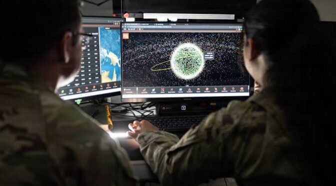


GPS has become so deeply connected to modern life that most people rarely think about what would happen if it suddenly stopped working.
A driver uses GPS to reach a destination. A delivery company uses satellite positioning to track vehicles. Aircraft use satellite navigation as part of their navigation architecture. Farmers use precision positioning for automated agricultural equipment. Smartphones use location services for maps, transportation, emergency services and countless applications.
But GPS is not guaranteed to work perfectly everywhere.
Signals can be blocked, degraded, jammed or spoofed. Buildings can weaken satellite signals. Dense forests can create difficult environments. Deliberate interference can make satellite navigation unreliable.
This has led to a growing technology field known as GPS-denied navigation.
The basic idea is simple:
What happens when a device has to determine its location without depending completely on GPS?
In the United States, this question is becoming increasingly important in 2026.
The U.S. Army has contracted Pacific Defense to develop a next-generation Assured Positioning, Navigation and Timing, or APNT, plug-in card designed for military platforms operating in environments where GPS may not be available or trustworthy. The program is part of the Army’s broader effort to improve resilient navigation capabilities.
At the same time, the U.S. Space Force is looking at a broader future for satellite navigation. Its 2040 planning document describes an open hybrid approach that combines diverse sources of positioning, navigation and timing information to make the overall system more resilient against jamming, spoofing, cyberattacks and other threats.
This represents a major shift.
The future of GPS technology is increasingly not about making one system impossible to disrupt.
Instead, engineers are developing systems that can continue working even when one navigation source fails.
What Is GPS-Denied Navigation?
GPS-denied navigation refers to technologies and techniques that allow a vehicle, aircraft, drone, robot or other platform to determine its position and movement when GPS signals are unavailable or unreliable.
The term does not necessarily mean that GPS is completely absent.
It can also describe situations where GPS is:
- Blocked
- Jammed
- Spoofed
- Too weak
- Unreliable
- Temporarily unavailable
A navigation system operating in this environment needs alternative information.
That information can come from:
- Inertial sensors
- Cameras
- Radar
- LiDAR
- Terrain maps
- Radio signals
- Cellular networks
- Other satellite constellations
- LEO satellites
- Vehicle sensors
- AI-powered algorithms
The objective is to create a navigation system that does not completely collapse when GPS becomes unreliable.
Why GPS-Denied Navigation Is Becoming Important
There are several reasons why this technology is attracting attention in the United States.
Increasing GPS Dependence
Modern society depends heavily on GPS.
The more systems depend on GPS, the more important resilience becomes.
GPS Jamming
Radio-frequency interference can disrupt satellite navigation.
GPS Spoofing
False signals can potentially cause receivers to calculate incorrect positions.
Autonomous Systems
Self-driving vehicles, drones and robots require reliable positioning.
Military Operations
Military platforms may operate in environments where satellite navigation is deliberately disrupted.
Critical Infrastructure
Telecommunications, transportation and other systems can depend on precise positioning and timing.
These factors are pushing engineers to develop alternative navigation technologies.
GPS Jamming vs GPS Spoofing
Understanding the difference between jamming and spoofing is important.
GPS Jamming
Jamming attempts to overwhelm or interfere with legitimate GPS signals.
The receiver may lose its ability to calculate a position.
GPS Spoofing
Spoofing is more deceptive.
A receiver may continue operating but receive false navigation information.
This can potentially cause the system to believe it is somewhere it is not.
For autonomous systems, spoofing can be particularly challenging because the system may not immediately recognize that the information is incorrect.
This is why resilient navigation increasingly focuses on comparing multiple independent data sources.
The Rise of Resilient PNT Technology
PNT stands for:
Positioning, Navigation and Timing.
GPS provides all three.
However, resilient PNT means maintaining these capabilities even when GPS or another primary source becomes unavailable.
The U.S. Space Force’s current planning specifically identifies resilient PNT as an important requirement and says the future architecture needs to adapt to growing jamming and spoofing threats.
The proposed approach is not simply to build another version of GPS.
Instead, it is to create an architecture that can combine different sources according to user needs.
This could eventually include:
GPS + LEO + inertial navigation + terrestrial signals + AI + other GNSS
Such an approach could be significantly more resilient.
U.S. Army Develops Next-Generation GPS-Denied Navigation
One of the most important developments in 2026 is the U.S. Army’s work on a next-generation APNT plug-in card.
Pacific Defense was selected to develop an enhanced version of its APNT card for military platforms under the Army’s CMOSS Mounted Form Factor program.
The significance of this technology goes beyond one piece of hardware.
Military platforms increasingly need to operate in environments where GPS cannot be trusted.
A navigation system that can continue functioning without GPS can provide an important operational advantage.
The plug-in approach is also interesting because modular technology can make it easier to upgrade systems without replacing an entire platform.
Why Inertial Navigation Is So Important
Inertial navigation is one of the oldest and most important alternatives to GPS.
An inertial navigation system uses sensors to measure movement.
These sensors can include:
- Accelerometers
- Gyroscopes
- Inertial measurement units
The system calculates how the vehicle is moving and estimates its position.
The major advantage is independence from external signals.
An inertial system does not need GPS satellites.
However, there is a major limitation.
Small sensor errors accumulate over time.
This means an inertial system can gradually become less accurate.
That is why modern navigation systems often combine inertial navigation with other technologies.
Sensor Fusion Could Be the Key
Sensor fusion means combining multiple sources of information.
Consider an autonomous vehicle.
It could use:
GPS: Global location
Camera: Road and landmark recognition
LiDAR: Three-dimensional environment
Radar: Object detection
IMU: Movement measurement
Map: Expected geographic environment
AI: Analysis and decision-making
If GPS becomes unavailable, the vehicle can continue using the other systems.
The system may become less accurate, but it does not necessarily become completely blind.
This is the central concept behind resilient navigation.
AI and GPS-Denied Navigation
Artificial intelligence could make GPS-denied navigation significantly more capable.
AI can process enormous amounts of sensor data.
For example, an autonomous vehicle could compare:
- GPS position
- Camera observations
- LiDAR map
- Inertial measurements
- Road geometry
If GPS suddenly reports a location that conflicts with everything else, the system could identify it as suspicious.
AI could also recognize environmental patterns.
A camera might identify:
- Road signs
- Buildings
- Lane markings
- Bridges
- Trees
- Terrain
These visual features can help determine where the vehicle is.
This technique is often called visual localization.
Computer Vision Can Help When GPS Is Unavailable
Computer vision is becoming an increasingly important navigation technology.
A camera can continuously observe the environment.
Software can compare what the camera sees against a digital map or previously collected imagery.
For example, a vehicle might recognize a specific building and use its location as a reference point.
This approach can be especially useful in urban areas.
However, computer vision has limitations.
Poor weather, darkness, dust, snow, changing landscapes and blocked visibility can reduce performance.
This is why computer vision is best used as part of a multi-sensor system rather than a single replacement for GPS.
LiDAR Navigation in GPS-Denied Environments
LiDAR is another promising technology.
LiDAR uses laser pulses to measure distances.
It can create detailed three-dimensional representations of the surrounding environment.
An autonomous vehicle can compare the LiDAR environment against a high-definition map.
If the vehicle recognizes a specific road structure or building arrangement, it can estimate its location.
This technology can work without GPS.
However, LiDAR systems can be expensive and require significant computing power.
Radar Can Provide Another Navigation Layer
Radar can also contribute to GPS-denied navigation.
Radar is useful because it can operate in conditions where cameras may struggle.
For example, radar can continue detecting objects in:
- Darkness
- Rain
- Fog
- Dust
Autonomous vehicles already use radar for object detection.
In the future, radar information could also contribute to localization.
The more independent information sources available, the more resilient the navigation system can become.
LEO Satellites Could Strengthen GPS Alternatives
Another major technology trend is the use of Low-Earth Orbit satellites.
LEO satellites operate much closer to Earth than traditional GPS satellites.
Because of their lower orbital altitude, their signals can potentially reach users at much higher power.
Research and commercial projects are exploring LEO-based positioning as a complement to GPS.
One company, Xona Space Systems, is developing a LEO navigation constellation called Pulsar. Recent reporting describes plans for a large LEO constellation designed to provide positioning, navigation and timing services.
The potential advantage is important.
A navigation receiver could potentially use:
GPS + LEO positioning
instead of relying only on traditional GNSS signals.
This could create another layer of resilience.
Could LEO Satellites Replace GPS?
Probably not in the near term.
GPS is already a mature global system with a huge installed user base.
Receivers, infrastructure and standards have been built around GPS for decades.
LEO navigation is better understood as a potential complementary technology.
Future navigation systems could combine multiple sources.
For example:
- GPS
- Other GNSS
- LEO satellites
- Inertial sensors
- Terrestrial signals
- AI
This could create a much more resilient navigation ecosystem.
GPS-Denied Navigation for Autonomous Cars
Self-driving cars represent one of the biggest commercial applications for resilient positioning.
An autonomous vehicle must know where it is at all times.
GPS can provide a global position, but that alone is not enough.
The vehicle also needs to understand:
- Which lane it occupies
- Where road boundaries are
- Where nearby vehicles are
- Where intersections are
- Where pedestrians are
- Where obstacles are
This means autonomous cars already depend on multiple sensors.
GPS-denied navigation could become a natural extension of this architecture.
GPS-Denied Navigation for Drones
Drones have an even stronger relationship with GPS.
Many drones use GPS for:
- Position holding
- Route planning
- Return-to-home
- Automated missions
- Mapping
- Geofencing
If GPS becomes unavailable, autonomous drone operations can become more difficult.
Future drones may combine:
- GPS
- IMU
- Cameras
- LiDAR
- Radar
- Terrain maps
- AI
This would allow the drone to continue navigating even if satellite signals become unreliable.
Why GPS-Denied Navigation Matters for Emergency Services
Emergency services can operate in difficult environments.
After a natural disaster, infrastructure may be damaged.
Buildings can collapse.
Communication networks can become unreliable.
GPS interference can also complicate navigation.
Emergency response teams could benefit from navigation systems that have multiple independent positioning sources.
This could be useful for:
- Search and rescue
- Fire response
- Disaster mapping
- Emergency medical transportation
- Infrastructure inspection
Resilient navigation is therefore not only a military technology.
It has important civilian applications as well.
GPS-Denied Navigation and Aviation
Aviation is another critical area.
Aircraft already use multiple navigation technologies.
GPS is important, but pilots and aircraft systems also have access to other navigation sources.
The increasing concern about GPS jamming and spoofing has highlighted the importance of maintaining backup capabilities.
A future aviation navigation system could combine:
- GPS
- Other GNSS
- Inertial navigation
- Ground-based navigation
- Radar
- Digital maps
- AI-based anomaly detection
This could help aircraft maintain situational awareness during periods of satellite navigation disruption.
GPS and Critical Infrastructure
GPS is also used for timing.
This is sometimes overlooked.
Highly accurate timing can support:
- Telecommunications
- Electrical grids
- Financial networks
- Data systems
- Transportation infrastructure
A GPS outage therefore does not necessarily mean only a map application stops working.
A broader range of systems can potentially be affected.
This is why resilient PNT has become an important technology and infrastructure issue.
The U.S. Is Moving Toward a Hybrid Navigation Architecture
The most important long-term trend may be the move toward hybrid positioning.
The U.S. Space Force’s 2040 baseline specifically describes an open hybrid approach in which inputs from diverse sources can be weighed according to user needs. The goal is a more dependable PNT capability that can withstand adversary action and allow faster technology upgrades.
This is a significant change in philosophy.
Instead of:
One satellite system → one navigation solution
the future could be:
Multiple independent sources → intelligent navigation solution
That is a much more flexible architecture.
GPS Modernization Still Remains Essential
Even with alternative navigation systems, GPS modernization remains important.
In April 2026, the U.S. Space Force successfully launched the final GPS III satellite, completing the GPS III series. The service described the constellation as its strongest and most resilient GPS constellation to date.
In June 2026, Space Systems Command announced another $514.4 million contract option for two additional GPS IIIF satellites, increasing the number of GPS IIIF satellites under contract to 14.
This shows that resilient navigation does not mean abandoning GPS.
Instead, the United States is simultaneously:
- Modernizing GPS
- Developing new satellites
- Improving receivers
- Exploring complementary navigation
- Developing GPS-denied technologies
- Strengthening PNT resilience
The Future of GPS Is More Than GPS
The term “GPS technology” may eventually become too narrow to describe the navigation systems used by advanced vehicles.
Future positioning could involve:
Satellite Navigation
GPS and other GNSS systems.
LEO Navigation
New satellite-based positioning signals.
Inertial Navigation
Independent motion measurement.
Computer Vision
Navigation using visual information.
LiDAR
Three-dimensional environmental mapping.
Radar
Object and environmental detection.
Terrestrial Signals
Cellular and other radio infrastructure.
AI
Intelligent sensor fusion and anomaly detection.
Together, these technologies can create a navigation system that is much harder to disrupt.
Challenges of GPS-Denied Navigation
GPS-denied navigation is promising, but it is not easy.
Sensor Costs
High-quality sensors can be expensive.
Computing Requirements
Real-time sensor fusion requires powerful processors.
Accuracy
Inertial systems can accumulate errors.
Weather
Cameras and LiDAR can be affected by environmental conditions.
Maps
High-quality maps are necessary for some localization techniques.
AI Reliability
AI systems must be carefully tested before being used in safety-critical applications.
Integration
Different sensors need to work together seamlessly.
These challenges will require years of research and development.
Will Smartphones Eventually Use GPS-Denied Navigation?
Consumer smartphones already use multiple location technologies.
They can combine GPS with:
- Wi-Fi
- Cellular networks
- Bluetooth
- Accelerometers
- Gyroscopes
Future phones could potentially add LEO navigation or other positioning sources.
However, the consumer market has different requirements from military or autonomous systems.
A smartphone can usually tolerate a few seconds of inaccurate positioning.
An autonomous aircraft may require much higher reliability.
Therefore, adoption will depend on the specific application.
What This Means for GPS Technology in 2026
The most important GPS development in 2026 may not be a new smartphone feature.
It may be the growing realization that GPS needs to operate as part of a larger resilient positioning ecosystem.
The United States is continuing to invest in traditional GPS satellites while simultaneously exploring new approaches to navigation.
The U.S. Army’s APNT development is one example of GPS-denied technology becoming a practical modernization priority.
The Space Force’s hybrid PNT strategy represents a broader architectural change.
And commercial LEO navigation projects demonstrate that alternatives to traditional satellite navigation are becoming a serious technology area.
Frequently Asked Questions
What is GPS-denied navigation?
GPS-denied navigation is the ability of a vehicle or system to determine its position and movement when GPS is unavailable, unreliable, jammed or spoofed.
Why is GPS-denied navigation important?
It provides backup capabilities for military systems, autonomous vehicles, drones, aircraft, emergency services and other technologies that depend on reliable positioning.
Can a vehicle navigate without GPS?
Yes. Vehicles can use inertial sensors, cameras, LiDAR, radar, maps and other technologies to estimate their position.
Can AI replace GPS?
AI is unlikely to completely replace GPS. Instead, AI can combine GPS with other sensors and identify potentially unreliable navigation information.
What is resilient PNT?
Resilient PNT means maintaining reliable positioning, navigation and timing even when one or more navigation sources are disrupted.
Are LEO satellites an alternative to GPS?
LEO satellites could become a complementary positioning technology. Companies are developing LEO navigation systems that could provide additional positioning, navigation and timing signals.
Is the U.S. still investing in GPS?
Yes. The U.S. Space Force completed the GPS III satellite series in April 2026 and continues procuring GPS IIIF satellites.
What is GPS spoofing?
GPS spoofing involves transmitting false navigation signals that can cause a receiver to calculate an incorrect position or time.
What is GPS jamming?
GPS jamming involves interference that prevents a receiver from properly processing legitimate satellite navigation signals.
Will GPS become obsolete?
No. GPS remains a foundational global positioning system. The future is more likely to involve GPS working alongside additional navigation technologies.
Conclusion
GPS has transformed the modern world, but the future of navigation will not depend on GPS alone.
The increasing use of autonomous vehicles, drones, aircraft, robotics and connected infrastructure means that reliable positioning is becoming more important than ever.
At the same time, GPS faces challenges from jamming, spoofing, signal obstruction and other forms of interference.
The solution is increasingly moving toward resilient navigation.
The U.S. Army’s development of next-generation APNT technology shows that GPS-denied navigation is becoming a practical technology priority.
The U.S. Space Force is also looking beyond a single-source navigation model. Its future planning calls for an open hybrid architecture capable of combining diverse PNT sources to create a more resilient system.
Meanwhile, GPS itself continues to evolve.
The final GPS III satellite reached orbit in April 2026, and the United States is already expanding the future GPS IIIF fleet.
This means the future is not GPS versus alternatives.
It is likely to be GPS plus alternatives.
A future autonomous vehicle might use GPS, LEO satellites, inertial sensors, cameras, LiDAR, radar and AI at the same time.
An aircraft could combine satellite navigation with inertial and ground-based systems.
A drone could use computer vision and terrain information when satellite signals are unavailable.
That is the real direction of next-generation navigation technology.
GPS will remain a critical foundation, but resilient positioning will become the next major evolution of the technology.
As the United States moves deeper into an era of autonomous transportation, advanced robotics, drones and connected infrastructure, GPS-denied navigation may become just as important as GPS itself.


