




Introduction
Global Positioning System (GPS) technology has become an essential part of everyday life in the United States. Millions of people depend on satellite navigation to reach their destinations, track deliveries, manage transportation, monitor outdoor activities, and access location-based services. What once served primarily as a specialized navigation technology has developed into an important part of the modern digital economy.
In 2026, GPS continues to play a significant role in the development of connected devices, intelligent transportation systems, commercial logistics, aviation, agriculture, and emergency response. American technology companies are also exploring new ways to combine satellite navigation with artificial intelligence, wireless communications, cloud computing, and real-time data analysis.
Another important development is the growing interest in satellite-to-smartphone connectivity. These services aim to extend certain forms of communication beyond the reach of traditional cellular networks. They complement satellite navigation rather than replacing GPS, but their development illustrates how satellite technology is becoming increasingly important to connected devices.
The United States continues to modernize its GPS infrastructure through improvements to satellites, signals, ground systems, and supporting technologies. According to the official GPS program, modernization is intended to improve civilian and military capabilities while supporting a wide range of applications. Readers can explore the program through GPS.gov’s GPS modernization overview.
This article examines how GPS technology is evolving in the United States, how American businesses use location data, why satellite connectivity matters, and what challenges companies must address as navigation becomes more closely connected to digital services.
What Is GPS Technology and How Does It Work?
The Global Positioning System is a satellite-based navigation system developed and operated by the United States government. It provides positioning, navigation, and timing information to compatible receivers around the world.
The system operates through three main components: satellites in space, ground-based control infrastructure, and receivers used by people and organizations.
GPS satellites continuously broadcast signals containing information that allows receivers to calculate their position. A smartphone, vehicle navigation unit, or specialized tracking device processes signals from multiple satellites to estimate its location and time.
A receiver generally needs signals from at least four satellites to calculate its three-dimensional position and correct for the receiver’s clock offset.
GPS does not normally require a smartphone to transmit its location to a satellite. Instead, the device receives satellite signals and calculates its position locally. Internet access may still be needed for features such as live traffic information, online maps, business listings, or cloud synchronization.
The distinction is important because GPS navigation and internet connectivity are separate capabilities. A device may determine its approximate location without a mobile data connection, provided it has compatible positioning hardware, sufficient satellite reception, and the necessary map information.
According to the Federal Aviation Administration’s explanation of GPS, satellite signals support positioning and timing across a broad range of applications.
GPS accuracy depends on several factors, including satellite visibility, atmospheric conditions, nearby buildings, receiver quality, and interference. In open areas, smartphones can often achieve location accuracy within several meters, although performance can vary significantly in cities, forests, tunnels, and indoor environments.
GPS Modernization in the United States
Maintaining a reliable navigation system requires continuous investment in satellite infrastructure and supporting technology.
The US GPS modernization program includes newer satellite generations, additional civilian signals, and improvements to ground-based control systems. These changes are designed to improve performance and support more demanding applications.
Modernized signals can offer advantages in signal quality, availability, interference resistance, and compatibility with advanced receivers. The practical benefits depend on the satellite signals available, receiver design, and the environment in which a device operates.
For civilian users, improvements may contribute to more reliable navigation and better performance in applications that require dependable positioning.
Aviation is one area where these improvements matter. Aircraft use satellite navigation alongside supporting systems and procedures to improve navigation capability and operational efficiency. The FAA also evaluates interference risks and technologies that can affect satellite navigation.
GPS modernization is not a single upgrade completed in one year. It is an ongoing program involving satellites, ground infrastructure, technical standards, and compatible user equipment.
Businesses developing navigation products should therefore consider long-term compatibility rather than assuming that every device will immediately benefit from each new satellite capability.
Official information about signals, infrastructure, and modernization is available from GPS.gov.
How GPS Supports the American Transportation Industry
Transportation is one of the most visible applications of GPS technology in the United States.
Drivers use satellite navigation to find routes, avoid traffic, estimate arrival times, and locate nearby services. Commercial transportation companies use GPS-enabled systems to monitor vehicles, coordinate deliveries, and improve operational visibility.
Fleet Management and Delivery Tracking
Delivery businesses frequently manage vehicles traveling across cities, highways, and rural communities. GPS tracking allows dispatchers to view vehicle locations and compare actual progress with planned routes.
When combined with traffic information, scheduling software, and operational data, location systems can help companies identify delays and make better delivery decisions.
For example, a logistics company serving multiple locations may use tracking information to identify which vehicles are closest to new delivery requests. Dispatchers can then consider travel distance, delivery deadlines, vehicle capacity, and driver availability when assigning work.
GPS does not eliminate every delay. Traffic congestion, severe weather, road closures, and inaccurate address information can still affect delivery schedules. However, reliable location data can help businesses respond more effectively.
Public Transportation
Public transportation agencies can use location information to monitor buses and other vehicles, estimate arrival times, and inform passengers about service disruptions.
Passengers benefit when mobile applications provide useful updates about approaching vehicles and changes to expected journey times.
Transit operators can also analyze historical movement data to identify recurring delays and assess service performance.
These applications demonstrate how GPS can improve the relationship between transportation providers and the people who depend on their services.
Connected and Autonomous Vehicles
GPS contributes to vehicle positioning, but advanced driver-assistance systems and autonomous vehicles require much more than satellite navigation alone.
Such systems may combine satellite positioning with cameras, radar, lidar, inertial sensors, detailed maps, and onboard computing.
The combination helps vehicles understand their surroundings and estimate their position when satellite reception becomes unreliable.
For American automotive technology companies, developing dependable positioning systems requires extensive testing under different road, weather, and traffic conditions.
Satellite-to-Smartphone Connectivity Is Expanding the Possibilities
One developing area of satellite technology is direct-to-device connectivity, which aims to allow compatible smartphones and other devices to communicate with satellites without relying entirely on traditional cellular towers.
This capability is particularly relevant to remote areas, rural highways, outdoor recreation locations, and other places where conventional mobile coverage may be limited.
In October 2026, Reuters reported that the Federal Communications Commission planned to vote on October 29 on proposals involving spectrum auctions intended to support satellite-to-device services. The report discussed efforts by companies including SpaceX and Amazon to expand satellite-enabled connectivity. The proposals and related regulatory decisions should be checked for their latest status before being described as finalized policy.
The development is covered in Reuters’ report on proposed FCC spectrum auction plans.
Satellite connectivity and GPS serve different purposes.
GPS primarily provides positioning, navigation, and timing signals. Satellite-to-device communications, by contrast, are designed to transmit information between compatible devices and satellite networks.
When these technologies work together, they may support more capable connected services. For example, a compatible device could determine its location through satellite navigation and use an available satellite communication service to send a message from an area without normal cellular coverage.
However, the availability of these features depends on device compatibility, service coverage, spectrum authorization, network capacity, and the particular capabilities offered by a provider.
Consumers should not assume that every smartphone can connect directly to satellites or that satellite messaging provides the same functionality as a full cellular broadband connection.
How Artificial Intelligence Is Improving GPS Applications
Artificial intelligence is becoming increasingly relevant to the way organizations interpret location information.
GPS can provide coordinates and movement data, but businesses often need additional systems to turn that information into useful decisions.
AI-powered analytics can examine historical routes, delivery schedules, traffic conditions, vehicle performance, and demand patterns. When combined with reliable data, these tools may help companies identify operational inefficiencies and improve planning.
Intelligent Route Planning
Traditional route planning often focuses on distance, travel time, and road restrictions.
More advanced systems can evaluate multiple factors, including changing traffic conditions, delivery priorities, vehicle capacity, and estimated service times.
AI-assisted tools may help dispatchers compare possible routes and respond to disruptions. For example, a delivery company could use location data and historical traffic patterns to estimate which routes are more likely to experience delays.
The quality of these recommendations depends on the quality and freshness of the underlying data. AI predictions should not be treated as guaranteed outcomes.
Predictive Fleet Maintenance
GPS-enabled fleet systems can be combined with vehicle diagnostics, maintenance records, and usage information.
An analytics platform may identify patterns suggesting that certain vehicles require inspection sooner than expected. This can help fleet operators plan maintenance and reduce unexpected downtime.
GPS alone cannot determine every mechanical problem. The strongest systems combine location information with relevant vehicle sensors and verified maintenance data.
Location Intelligence for Businesses
Retailers, property companies, logistics providers, and urban planners may use location analytics to understand geographic patterns.
A retailer might examine travel patterns around its stores, while a logistics company could study delivery density across different regions.
These insights can inform decisions about warehouse locations, service coverage, staffing, and distribution networks.
Businesses must ensure that their data collection practices respect privacy requirements and that location information is used for legitimate purposes.
The Growing Importance of GPS in Agriculture
Agriculture is another major application area for satellite positioning in the United States.
American farms can cover large areas and require careful coordination of equipment, field operations, irrigation, and crop management. GPS-based systems help agricultural businesses determine equipment positions and guide machinery through planned routes.
Precision agriculture uses location information to support more targeted field operations.
Depending on the equipment and application, farmers may use satellite positioning to guide tractors, map fields, coordinate planting, and support more consistent application of agricultural inputs.
Some specialized systems combine GPS with additional correction services to achieve much higher positioning accuracy than ordinary consumer devices.
These technologies can help reduce overlapping passes, improve operational consistency, and make more efficient use of equipment.
However, the benefits depend on farm size, terrain, equipment costs, available technical support, and the suitability of the technology for the operation.
Agricultural businesses must also plan for periods when satellite signals are degraded or unavailable. Reliable operating procedures are important when navigation errors could affect machinery or worker safety.
GPS and Emergency Response Across the United States
Emergency services depend on accurate information to coordinate responses and locate incidents.
GPS-enabled devices can provide location information that helps emergency personnel, field teams, and supporting organizations understand where assistance may be needed.
Location information can also support disaster management, search-and-rescue operations, and coordination among teams working across large geographic areas.
For example, during a wildfire or major storm, location-enabled equipment may help authorized response teams track resources and coordinate activity across affected regions.
However, GPS should not be viewed as a complete emergency communication system.
Positioning accuracy can be reduced by buildings, terrain, interference, and other environmental conditions. Emergency calls, dispatch systems, communication networks, and trained personnel remain essential.
Organizations should also establish procedures for sharing location information securely and ensuring that responders understand the limitations of the data they receive.
Cybersecurity Risks and GPS Interference
Despite its many benefits, GPS technology faces technical and security challenges.
Satellite signals travel long distances and arrive at receivers with relatively low power. As a result, they can be affected by interference or deliberate attempts to disrupt or manipulate navigation.
Two important concerns are jamming and spoofing.
Jamming involves interference that prevents a receiver from reliably acquiring or processing legitimate satellite signals.
Spoofing involves misleading signals or information that can cause a receiver to calculate an incorrect position or time.
These risks are important for aviation, transportation, maritime activity, industrial operations, and other applications that depend on reliable positioning.
The FAA identifies GPS interference, jamming, and spoofing among the issues relevant to satellite navigation systems.
Businesses that rely on GPS should consider safeguards appropriate to their operational risks. These may include monitoring signal quality, checking for inconsistent position information, combining GPS with other sensors, and establishing alternative operating procedures.
Critical applications may require redundant navigation sources and specialized equipment designed to detect or mitigate interference.
Organizations should also protect the software and communication systems that process location information. A GPS receiver may produce accurate coordinates, but the applications using those coordinates can still be vulnerable to cyberattacks or poor configuration.
Protecting Privacy When Using Location-Based Services
GPS-enabled applications can collect information about where people travel, how frequently they visit particular locations, and how devices move over time.
Such information can be useful for navigation, delivery coordination, fitness applications, and other services. However, detailed location histories can also reveal sensitive personal patterns.
Companies should explain why location data is collected, how long it is retained, and which parties can access it.
Consumers can take practical steps to protect their information:
- Review location permissions on smartphones and connected devices.
- Allow background location access only when it is necessary.
- Check whether applications offer options to limit location history.
- Remove access for applications that no longer need location information.
- Review account security and data-sharing settings.
- Be cautious when sharing real-time location publicly.
Businesses should apply appropriate access controls, retention limits, and security measures to the location information they manage.
Privacy protection is not simply a technical requirement. It is also important for maintaining customer confidence in digital services.
Challenges Facing the Future of GPS Technology
Although GPS remains a widely used navigation system, several challenges will influence its future development.
Signal Limitations
Buildings, tunnels, dense urban environments, and natural obstacles can weaken or block satellite signals.
Devices may require additional sensors, assistance data, or alternative positioning technologies to maintain reliable performance.
Infrastructure and Modernization Costs
Maintaining a global satellite navigation system requires long-term investment in satellites, ground facilities, testing, and technical support.
Modernization must balance improvements in capability with reliability, compatibility, and operational continuity.
Dependence on Multiple Technology Providers
Modern navigation services often depend on a combination of device manufacturers, satellite operators, mapping companies, wireless networks, and software developers.
Changes in one part of this ecosystem can affect service availability or product compatibility.
Data Quality and Reliability
Incorrect maps, outdated road information, inaccurate timestamps, or poorly configured software can reduce the usefulness of otherwise reliable positioning data.
Companies should regularly evaluate the entire navigation workflow rather than assuming that accurate GPS coordinates automatically guarantee an accurate final result.
Skills and Adoption Costs
Advanced tracking equipment, precision agriculture systems, and integrated navigation platforms can require significant investment and training.
Smaller businesses may need to introduce these technologies gradually to manage costs and ensure that employees can use them effectively.
What Businesses Should Consider Before Investing in GPS Solutions
Organizations planning to introduce GPS-enabled technology should begin by identifying the problem they want to solve.
A delivery company may prioritize real-time fleet visibility, while an agricultural business may need highly accurate equipment guidance. A consumer application may focus on navigation convenience and battery efficiency.
Once the objective is clear, businesses should evaluate several factors.
First, determine the level of positioning accuracy required. Not every application needs specialized high-precision equipment.
Second, examine operating conditions. A device designed for open roads may not perform equally well in dense urban areas or industrial environments.
Third, evaluate the total cost of ownership, including hardware, subscriptions, maintenance, connectivity, software integration, and employee training.
Fourth, review data protection and cybersecurity requirements, particularly when tracking employees, vehicles, or sensitive assets.
Finally, test the technology under realistic conditions before deploying it across an entire organization.
A carefully planned pilot can reveal coverage gaps, integration problems, and unexpected expenses before they become larger operational issues.
The Future of GPS Technology in the USA
GPS is likely to remain an important foundation for navigation and timing across the United States.
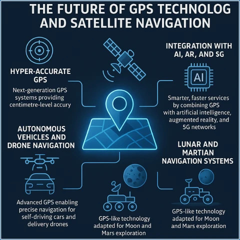
Future developments will involve not only improvements to satellite infrastructure but also better integration with complementary technologies.
Connected devices may increasingly combine satellite navigation with cellular networks, satellite communications, inertial sensors, cloud platforms, and AI-assisted analytics.
Transportation businesses may use more sophisticated location intelligence, agricultural operations may continue adopting precision technologies, and emergency organizations may develop improved tools for coordinating field activities.
At the same time, dependable navigation will require continued attention to cybersecurity, interference detection, infrastructure modernization, and operational resilience.
It is also important to recognize that technological progress does not guarantee immediate adoption. New capabilities must be tested, approved where necessary, integrated into compatible equipment, and made economically practical.
For consumers, this means navigation applications will continue to evolve, but the availability of particular features will depend on the device, service provider, and operating environment.
For businesses, the opportunity lies in using location data to make measurable improvements rather than adopting technology simply because it is new.
Conclusion
GPS technology remains a critical part of the American digital infrastructure in 2026. Its applications extend well beyond smartphone navigation, supporting transportation, logistics, agriculture, aviation, emergency response, and a wide range of commercial services.
The modernization of GPS infrastructure is helping prepare the system for evolving requirements, while developments in AI, connected devices, and satellite communications are creating additional possibilities.
Satellite-to-smartphone connectivity is especially noteworthy because it addresses a different challenge from GPS itself: extending communication into areas where conventional cellular networks may be unavailable.
Nevertheless, reliable navigation requires more than satellites. Businesses and public agencies must also consider interference, cybersecurity, privacy, data quality, compatible equipment, and operational costs.
Organizations that evaluate these factors carefully can use GPS-based solutions to improve planning, increase visibility, and support more informed decisions.
As satellite navigation and connected technology continue to develop, GPS will remain an important foundation for location-based innovation in the United States and around the world.
Frequently Asked Questions About GPS Technology in the USA
1. What is the future of GPS technology in the United States?
The future includes continued satellite modernization, improved civilian signals, integration with other positioning technologies, and expanded use in transportation, agriculture, logistics, and connected devices.
2. Does GPS require an internet connection?
No. A compatible GPS receiver can calculate its position from satellite signals without mobile internet access. However, live traffic, online maps, and many connected services may require internet connectivity.
3. How accurate is GPS on a smartphone?
Accuracy varies by device and environment. Under open skies, smartphones can often achieve accuracy within several meters. Buildings, trees, interference, and receiver limitations can reduce performance.
4. How are American businesses using GPS?
Businesses use GPS for vehicle tracking, delivery management, route planning, agricultural equipment guidance, asset monitoring, and location-based analytics.
5. What is the difference between GPS and satellite internet?
GPS provides positioning, navigation, and timing signals. Satellite internet and satellite communications transmit data between compatible devices and network infrastructure. They serve different but potentially complementary purposes.
6. Can GPS signals be disrupted?
Yes. Jamming can interfere with legitimate signals, while spoofing can mislead receivers about their position or timing. Systems used in critical operations may need interference monitoring and alternative positioning capabilities.
7. Is GPS free to use in the USA?
The US government provides the civilian GPS service worldwide without direct user fees. However, commercial navigation applications, mapping services, tracking hardware, and specialized correction services may charge for their products or features.
8. Why is GPS modernization important?
Modernization introduces improved satellite capabilities, new civilian signals, and updated supporting infrastructure. These improvements help sustain GPS for future civilian, commercial, and government applications.


